A Pint of History, Please!
Welcome to pint-of-history.wales
What's it all about?
Pint of History is a project about pubs. Pubs in Ceredigion. Old pubs, new pubs, beer houses, ale houses, taverns, inns, hotels, railway waiting rooms and breweries. And, to be fair, the odd Temperance hotel and cocoa house.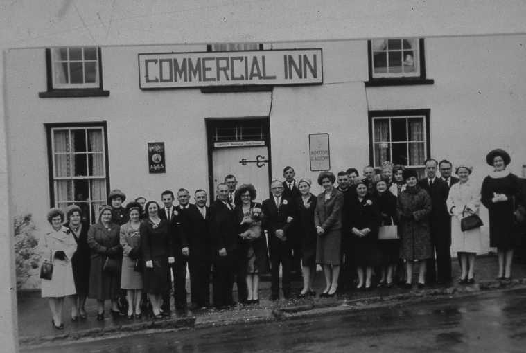
The project is being co-ordinated by Ceredigion Local History Forum as part of the wider Cynefin project run by Archives and Records Council Wales
This site is still growing! You can help by contributing stories, documents and pictures about the pubs of Ceredigion or we can help you enter the information yourself.
However you want to help, please contact us at
And would you like to find out more? Members of the project team are happy to come and talk to local groups - History societies, social clubs, WIs etc - about the project, in English or in Welsh. Contact us by email if you're interested.
Cynefin

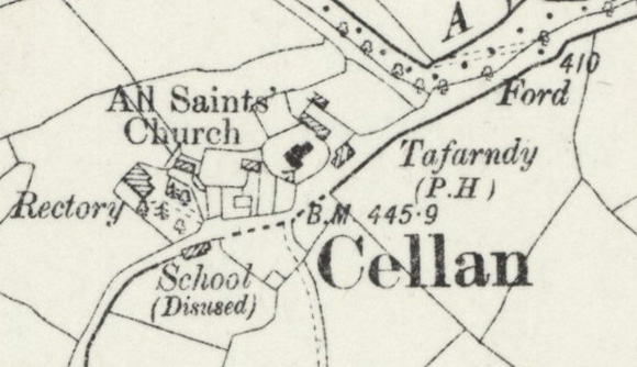
Tre\'r Ddôl on the Tithe map of 1844
Tithes were payments charged on land users. Originally, payments were made using commodities like crops, wool, milk and stock. Tithe maps were produced between 1838 and 1850 to ensure that all tithes were paid with money rather than produce.
These are the most detailed maps of their period and they cover more than 95% of Wales.
You can view the tithe maps at https://places.library.wales